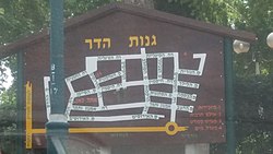
Ganot Hadar
Appearance
You can help expand this article with text translated from the corresponding article in Hebrew. Click [show] for important translation instructions.
|
Ganot Hadar
גַּנּוֹת הָדָר | |
|---|---|
 Map of the settlement | |
| Coordinates: 32°19′12″N 34°54′1″E / 32.32000°N 34.90028°E | |
| Country | Israel |
| District | Central |
| Council | Lev HaSharon |
| Founded | 1954 |
| Founded by | South African immigrants |
| Population (2022)[1] | 946 |
Ganot Hadar (Hebrew: גַּנּוֹת הָדָר, lit. 'Citrus Gardens') is a community settlement in central Israel. Located in the Sharon plain, it falls under the jurisdiction of Lev HaSharon Regional Council. In 2022 it had a population of 946.[1]
History
[edit]The village was founded in 1954 and was designated for immigrants from South Africa. Its name was derived from the surrounding groves.
References
[edit]- ^ a b "Regional Statistics". Israel Central Bureau of Statistics. Retrieved 21 March 2024.

